049 Rivers and Creeks in New York State: Following the Water
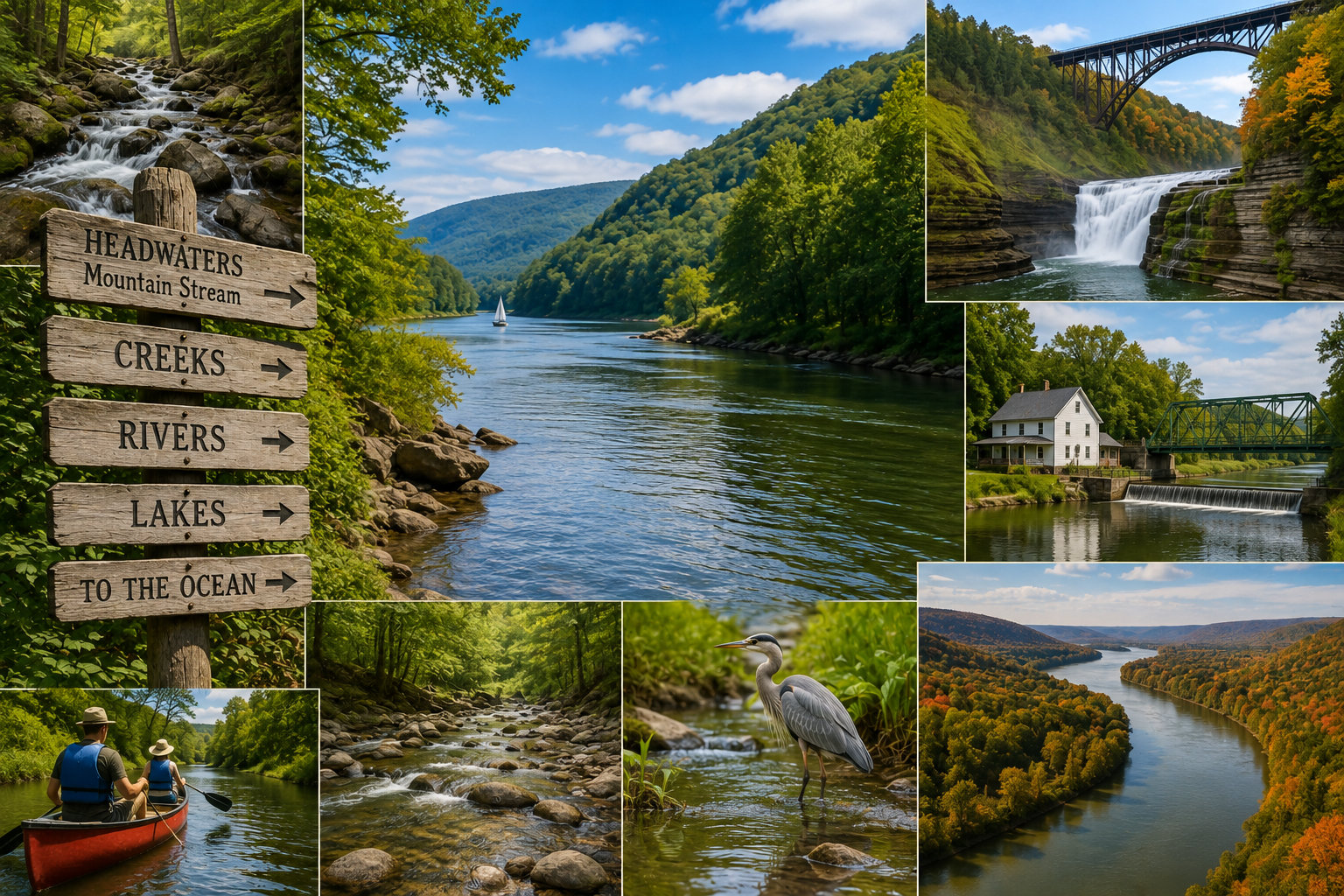
Find a creek.
Follow it downstream.
Eventually it joins something larger.
That creek may enter a river.
The river may enter a lake.
Another river may carry the water onward.
And eventually, water that began as rain or snow somewhere in New York may reach the Atlantic Ocean, Chesapeake Bay, Gulf of St. Lawrence or even the Gulf of Mexico.
That is one of the fascinating things about rivers and creeks.
They connect the landscape.
New York is covered by an enormous network of streams, creeks and rivers.
Some are famous.
The Hudson.
Susquehanna.
Delaware.
Mohawk.
Genesee.
Black.
St. Lawrence.
Others are small enough to step across.
But every one of them is part of something larger.
Where Does a River Begin?
A river rarely begins as a river.
It may begin with groundwater emerging from a spring.
Snow melting from a hillside.
Water draining from a wetland.
A tiny stream flowing out of a pond or lake.
Small streams join other small streams.
The flow grows.
A creek becomes larger.
Tributaries join it.
Eventually we give the growing waterway a name and call it a river.
But there is no moment when nature puts up a sign saying:
“River begins here.”
The Watershed
To really understand a river, we need to look beyond the river itself.
Every river has a watershed.
A watershed is the area of land that drains toward a particular body of water.
Rain falling on one side of a ridge may eventually enter one river.
Rain falling only a short distance away on the other side may travel toward an entirely different river system.
Mountains, hills and ridges divide watersheds.
Water connects everything within them.
New York's 17 Major Watersheds
New York State is divided into 17 major drainage basins or watersheds.
They range from the Hudson and Mohawk systems to the Great Lakes, Susquehanna, Delaware, Lake Champlain and St. Lawrence watersheds.
This means New York water travels in several very different directions.
Some heads east.
Some south.
Some north.
And some eventually travels west and south toward the Mississippi River system.
Stand beside a small New York creek and you may be looking at the beginning of an extraordinarily long journey.
The Hudson River
The Hudson is probably New York's most historically important river.
Its headwaters begin in the Adirondacks.
From there, the river travels generally south through eastern New York toward New York Harbor.
Communities grew along it.
Ships traveled it.
Industry used it.
Railroads followed it.
Bridges crossed it.
Artists painted it.
And the Erie Canal eventually connected it with the Great Lakes.
The Hudson became one of the great transportation corridors in American history.
The Hudson Becomes an Estuary
But the lower Hudson is not simply a freshwater river.
From the Troy Dam south toward New York Harbor, the Hudson is a tidal estuary.
Ocean tides influence water levels far upriver.
Fresh water flowing downstream meets saltier water moving inland from the Atlantic.
The result is a dynamic environment where salinity changes by location, season, rainfall and river flow.
The Hudson therefore connects mountains in the Adirondacks with the Atlantic Ocean in a very direct way.
The Mohawk River
The Mohawk flows east across central New York and joins the Hudson near Albany.
Its valley provided something extremely important.
A relatively low passage through the Appalachian landscape.
Native peoples used the corridor.
Settlers followed it.
The Erie Canal used it.
Railroads followed it.
Modern highways still use much of the same general route.
The river helped determine where New Yorkers traveled long before anyone built a canal or railroad.
The River Came First
This is worth remembering.
When we study transportation history, it is easy to focus on what people built.
Canals.
Railroads.
Roads.
Bridges.
But many of those routes exist where they do because rivers had already identified practical pathways through the landscape.
The river came first.
The Susquehanna Begins in New York
One of America's great rivers begins quietly in New York.
The Susquehanna flows from Otsego Lake at Cooperstown.
From there it travels through New York and Pennsylvania before eventually reaching Chesapeake Bay in Maryland.
The entire river is more than 400 miles long.
So water leaving beautiful Otsego Lake becomes part of an enormous river system connecting central New York with the Chesapeake.
New York and Chesapeake Bay
This creates a connection many people may not immediately consider.
What happens to water in portions of New York can affect Chesapeake Bay hundreds of miles away.
Runoff entering streams in the Southern Tier can eventually enter the Susquehanna.
The Susquehanna is the largest source of freshwater entering Chesapeake Bay.
A watershed does not care about state boundaries.
Water simply continues downhill.
The Chemung River
The Chemung River crosses New York's Southern Tier before joining the Susquehanna system in Pennsylvania.
Its watershed includes rivers and creeks draining portions of Steuben, Chemung and surrounding counties.
The Chemung is another example of how southern New York is connected hydrologically with Chesapeake Bay.
A river we think of as local can actually be part of a much larger regional system.
The Delaware River
The Delaware begins with branches draining the Catskills and surrounding areas.
For part of its journey, the river forms the boundary between New York and Pennsylvania.
Eventually it flows past major population centers and reaches Delaware Bay and the Atlantic Ocean.
The upper Delaware is dramatically different from the heavily developed lower river.
Forested hillsides, clear water and scenic stretches make portions of the river especially popular for paddling, fishing and wildlife watching.
New York City Drinks From the Watershed
Water from portions of the Catskills and Delaware watershed also plays an enormous role in New York City's drinking-water system.
Reservoirs capture water from large protected watersheds and transport it toward the metropolitan region.
Someone turning on a faucet in New York City may therefore be drinking water that began as rain or snow falling many miles away in an upstate landscape.
Watersheds connect rural and urban New York.
The Genesee River
The Genesee is unusual among major New York rivers because it flows north.
Its headwaters actually begin in Pennsylvania before the river enters New York and continues northward.
Along the way it passes through one of the state's most spectacular landscapes.
Letchworth State Park.
There the river cuts through a deep gorge and plunges over major waterfalls.
It eventually reaches Rochester, where it creates another major waterfall before entering Lake Ontario.
Rivers Make Waterfalls
Our waterfall topic and river topic naturally overlap.
A waterfall is simply one moment in the life of a river or stream.
The water was flowing before the falls.
It continues flowing afterward.
Where geology creates a sudden change in elevation, gravity creates the waterfall.
Then the river continues downstream.
The Black River
The Black River drains portions of the western Adirondacks and the eastern side of the Tug Hill Plateau.
It eventually flows through Watertown and enters Lake Ontario.
The river and its tributaries pass through a region known for forests, heavy snowfall and outdoor recreation.
Its watershed includes the Moose, Beaver and Independence river systems along with numerous smaller creeks.
Here again, the main river is only part of the story.
Tug Hill and Water
Tug Hill receives extraordinary amounts of snow.
Eventually much of that snow becomes water.
Spring snowmelt feeds creeks and rivers.
Streams rise.
Waterfalls become more powerful.
Wetlands fill.
The water begins moving toward Lake Ontario and other surrounding drainage systems.
Snow is really stored water waiting for spring.
The Raquette River
The Raquette is one of the major rivers draining the Adirondacks toward the St. Lawrence River.
It passes through a landscape of forests, lakes and communities.
Like many Adirondack rivers, portions have been modified by dams and reservoirs.
Yet the river remains an important recreational and ecological corridor.
The St. Lawrence River
The St. Lawrence is on an entirely different scale.
It carries water from the Great Lakes toward the Atlantic Ocean.
Along New York's northern boundary, it separates the United States and Canada.
Large ships use the St. Lawrence Seaway to travel between the Great Lakes and the ocean.
Water that passes Niagara Falls eventually reaches Lake Ontario, then enters the St. Lawrence and continues toward the Atlantic.
The Great Lakes may feel almost like inland seas.
The St. Lawrence gives them an outlet to the ocean.
The Niagara River
The Niagara River connects Lake Erie and Lake Ontario.
It is relatively short compared with many famous rivers.
But what happens along that short journey is extraordinary.
The river drops dramatically in elevation.
Niagara Falls occurs along the way.
Hydroelectric facilities use part of the river's enormous energy.
Then the water continues toward Lake Ontario.
A short river can still be enormously important.
The Allegheny River
Southwestern New York provides another surprising water journey.
Headwaters of the Allegheny River occur in this region.
The river flows into Pennsylvania and eventually joins the Monongahela at Pittsburgh to form the Ohio River.
The Ohio joins the Mississippi.
The Mississippi flows to the Gulf of Mexico.
Think about that.
Some rain falling in New York State eventually reaches the Gulf of Mexico.
Which Ocean Does Your Rain Reach?
This makes an interesting question to ask wherever you are in New York.
If rain falls here today, where does it ultimately go?
The Atlantic through the Hudson?
Chesapeake Bay through the Susquehanna?
The Atlantic through the Delaware?
The Gulf of St. Lawrence through the Great Lakes?
The Gulf of Mexico through the Allegheny, Ohio and Mississippi?
Understanding watersheds turns a local rainstorm into a geography lesson.
Creeks Are the Beginning
Large rivers receive most of the attention.
But rivers depend upon smaller water.
Creeks.
Brooks.
Streams.
Springs.
Wetlands.
Drainage channels.
Thousands of small tributaries collect water from the landscape and deliver it downstream.
If we want healthy rivers, we need healthy creeks.
What Is the Difference Between a Creek and a River?
There is no universal size at which a creek officially becomes a river.
Names often reflect history and local usage rather than strict scientific definitions.
Some waterways called creeks are surprisingly large.
Some rivers are relatively small.
The name tells us something about how people historically understood the waterway, but not necessarily its exact size.
Every Creek Has a Personality
Walk along several New York creeks and they can feel completely different.
A mountain stream may tumble over boulders.
A limestone creek may disappear underground and reappear somewhere else.
A lowland stream may meander slowly through wetlands.
A creek flowing through shale may carve a narrow gorge.
A spring-fed stream may remain unusually cold even in summer.
The geology and landscape determine the character of the water.
Cold-Water Streams
Some New York streams remain cold enough to support trout and other species adapted to cool water.
Groundwater can be especially important.
Water emerging from springs often remains much cooler in summer than surface runoff.
Forested stream banks also provide shade.
Keeping streams cool can be critical to maintaining healthy cold-water habitat.
Trees Along the Creek
Vegetation along streams does far more than make the shoreline look natural.
Roots help stabilize banks.
Trees provide shade.
Leaves and insects provide food for aquatic ecosystems.
Fallen branches create pools and cover.
Vegetated buffers can also help filter runoff before it reaches the water.
A healthy stream includes the land beside it.
Rivers Move
We draw rivers as fixed blue lines on maps.
Real rivers move.
They erode one bank.
Deposit sediment on another.
Meanders grow.
Channels shift.
Floods create new pathways.
Over enough time, a river can move dramatically across its valley.
A map captures only one moment.
Why Rivers Curve
Water flowing around a bend moves at different speeds.
The faster current tends to erode the outside of the bend.
Slower water deposits sediment on the inside.
The bend gradually becomes more pronounced.
This creates the familiar meandering pattern seen in many low-gradient rivers.
The river is continually rebuilding its own banks.
Oxbow Lakes
Eventually a large river bend may become so exaggerated that the river cuts across the narrow neck between two sections.
The main current begins following the shorter route.
The abandoned bend can become an oxbow lake.
A piece of the old river remains beside the new river.
Landscapes preserve history in unexpected ways.
Floodplains
Rivers naturally overflow their banks.
The relatively flat land surrounding many rivers is a floodplain because water has repeatedly occupied it.
Floodwaters spread across the valley and deposit sediment.
Those sediments can create fertile agricultural soils.
That is one reason farms often developed in river valleys.
But fertile floodplain soil comes with a tradeoff.
Eventually the river will flood again.
A Flood Is Not Always a River Misbehaving
From a human perspective, flooding can be destructive and dangerous.
But from the river's perspective, spreading onto a floodplain can be part of its natural behavior.
Problems become especially serious when homes, roads and businesses occupy areas the river periodically needs.
Understanding floodplains means understanding that rivers require space.
Floods Change Rivers Quickly
Most river change happens slowly.
Floods can accelerate the process dramatically.
A single major storm can:
- Move enormous boulders
- Destroy stream banks
- Create gravel bars
- Move trees
- Change channels
- Damage bridges
- Alter swimming holes
- Expose new bedrock
Return to a familiar creek after a major flood and it may look like a different place.
The Power of Moving Water
Water does not look particularly strong when held in your hand.
Give it gravity, volume and speed and everything changes.
Moving water transports soil.
Sand.
Gravel.
Cobbles.
Logs.
And during floods, surprisingly large rocks.
The river is both water and the material the water carries.
Rivers Build as Well as Destroy
Erosion gets most of the attention.
But rivers also deposit material.
When water slows, it can no longer carry as much sediment.
Sand settles.
Gravel accumulates.
New bars form.
Floodplains grow.
A river continually moves pieces of the landscape from one place to another.
Rivers Powered New York
Long before widespread electricity, flowing water provided mechanical power.
Communities built mills beside creeks and rivers.
Water turned wheels and turbines.
That power operated:
- Sawmills
- Gristmills
- Textile mills
- Paper mills
- Machine shops
- Other early industries
Many New York communities developed where water provided useful power.
Look for Old Mill Sites
Even when the mill is gone, evidence may remain.
A stone foundation.
An old dam.
A millrace.
A channel beside the creek.
An unusually straight section of water.
A road named Mill Street.
The creek can help explain why the town developed where it did.
Hydroelectric Power
Eventually the energy in flowing water was converted into electricity.
Dams and hydroelectric stations appeared on many rivers.
New York continues to generate substantial electricity from water.
Hydropower demonstrates the same principle used by an old waterwheel.
Moving water contains usable energy.
The technology became much larger.
Dams Change Rivers
Dams can provide electricity, flood control, drinking water, recreation and other benefits.
But they also change river ecosystems.
A free-flowing river becomes a reservoir.
Sediment movement changes.
Water temperature may change.
Fish migration can be interrupted.
Downstream flow patterns may be altered.
Like many forms of infrastructure, dams involve tradeoffs.
Some Dams Are Coming Out
Old dams that no longer provide enough benefit may sometimes be removed.
Removing a dam can restore fish passage and reconnect river habitat.
But removal must also be carefully planned because sediment and ecosystems have adjusted to the dam's presence.
Restoring a river is not always as simple as knocking down a wall.
Fish Follow Rivers Too
Rivers are transportation systems for wildlife.
Fish move between habitats.
Birds follow river corridors.
Mammals travel along shorelines.
Insects emerge from water and become food for animals on land.
A river connects ecosystems as effectively as it connects geography.
Fishing New York's Rivers and Creeks
New York offers enormous variety for anglers.
Cold mountain streams may contain brook trout.
Larger creeks support brown and rainbow trout.
Warm-water rivers may contain bass, walleye, northern pike and other species.
Great Lakes tributaries can attract salmon and steelhead during seasonal migrations.
Fishing provides another way of learning how water temperature, current, depth and habitat influence where animals live.
The Salmon River
The Salmon River in northern New York is particularly famous among anglers.
Fish moving from Lake Ontario enter the river during seasonal spawning runs.
That creates an unusual connection between a Great Lake and a comparatively modest river.
For portions of the year, fish moving upstream become the main attraction.
Canoes and Kayaks
Rivers and creeks also create natural travel routes for paddlers.
A canoe allows us to experience a river at river speed.
You notice things that are easy to miss from a road.
A kingfisher flying ahead.
A turtle leaving a log.
A beaver lodge.
A gravel bar.
A tributary entering from the side.
A cliff invisible from the highway.
Traveling on the water changes your perspective.
Know the River Before You Paddle
Not every river is appropriate for every paddler.
Current changes with water level.
Dams create hazards.
Fallen trees can block channels.
Cold water can make immersion dangerous even when the air feels warm.
Rapids require skill.
Conditions after heavy rain can be completely different from normal conditions.
Research the route, water level, access points and hazards before launching.
Creek Walking
Sometimes exploring a creek does not require a boat.
Shallow streams can reveal geology particularly well.
Bedrock.
Fossils.
Rounded stones.
Small waterfalls.
Deep pools.
Gravel bars.
Every bend exposes another part of the landscape.
But even small creeks deserve respect.
Wet rocks can be extremely slippery and water levels can rise rapidly.
Swimming Holes
Generations of New Yorkers have grown up with favorite swimming holes.
A deep pool beneath a small waterfall.
A quiet bend in a river.
A rope swing.
A flat rock warmed by the sun.
These places become part of local memory.
But natural water is not a swimming pool.
Depth changes.
Currents change.
Floods move rocks and logs.
Never assume a familiar swimming hole is exactly the way you remember it.
Rivers in Winter
Winter changes rivers dramatically.
Ice forms along shorelines.
Small streams may disappear beneath snow.
Water continues flowing below ice.
Freeze-and-thaw cycles create unusual formations.
During spring breakup, moving ice can become a powerful force.
New York rivers have a seasonal personality just as waterfalls do.
Spring Is Moving-Water Season
Snowmelt and spring rain often create some of the year's strongest flows.
Small creeks become larger.
Seasonal streams reappear.
Waterfalls gain power.
Wetlands overflow.
Rivers rise.
It is one of the best seasons to appreciate how much water actually moves through the New York landscape.
Water Quality Begins Upstream
What enters a small stream does not necessarily stay there.
Oil.
Road salt.
Fertilizer.
Sediment.
Litter.
Wastewater.
Anything entering a tributary may continue downstream.
This is why watershed protection must include even very small streams.
Everything Is Downstream From Somewhere
This may be the simplest way to understand a watershed.
Everyone lives downstream from somebody.
And almost everyone lives upstream from somebody else.
The water leaving our property becomes someone else's water.
That makes water quality a shared responsibility.
Wetlands Are Part of the System
Wetlands and rivers are closely connected.
Wetlands can temporarily store water.
They provide wildlife habitat.
They can slow runoff.
They trap some sediment.
They help create transitions between land and open water.
A healthy river system is often much larger than the visible river channel.
Beavers Are River Engineers
Humans are not the only animals that modify streams.
Beavers build dams.
A small flowing creek becomes a pond or wetland.
Trees die in newly flooded areas.
New plants appear.
Waterfowl arrive.
Amphibians use the wetlands.
Eventually the dam may fail or be abandoned and the landscape changes again.
A beaver can dramatically reshape a watershed without an engineering degree.
Bridges Tell Us Where Water Interrupted Travel
Our covered-bridge topic connects naturally with rivers and creeks.
People could travel easily until they reached water.
Then they needed a ford, ferry or bridge.
River crossings became important places.
Roads converged.
Communities sometimes developed nearby.
A bridge is really a story about two transportation systems crossing each other.
The road wants to go one direction.
The river is already going another.
Railroads Followed Rivers
Our railroad topic connects too.
Railroad engineers preferred gradual grades.
River valleys often provided them.
That is why old railroad lines frequently parallel rivers.
Highways later followed many of the same valleys.
The landscape kept influencing the route.
Rivers Connect Our Topics
Think about how many of our Discover New York State topics eventually return to water.
Waterfalls require rivers.
Covered bridges cross them.
Railroads follow them.
Canals connect them.
Birds use them.
Wine regions benefit from nearby water.
Caves are created by groundwater.
Historic towns grew beside streams.
Water is one of the threads connecting New York's landscape and history.
Explore a River From Beginning to End
Here is an interesting way to discover New York.
Choose a river.
Find its source.
Then follow it on a map.
Which towns does it pass?
Which tributaries enter it?
Where are the waterfalls?
Where were mills built?
Which railroads followed it?
Where are the dams?
Where can you paddle?
Where does the river finally end?
You may discover an entire region simply by following the water.
Explore the Tributaries Too
Then work backward.
Pick one creek entering the river.
Follow that upstream.
Then choose one of its smaller tributaries.
Eventually you reach water small enough to step across.
Yet that tiny stream is connected to everything downstream.
A New York River Road Trip
New York offers an extraordinary variety of river experiences.
- Hudson River: History, scenery, tidal estuary, boating and communities from the Adirondacks to New York Harbor.
- Mohawk River: Explore the natural corridor that helped shape the Erie Canal, railroad and highway routes.
- Upper Delaware: Scenic water, paddling, fishing and forested river valleys.
- Susquehanna: Follow one of America's great rivers from its beginning at Otsego Lake.
- Genesee River: Experience waterfalls and spectacular gorge scenery at Letchworth and Rochester.
- Black River: Discover a major North Country river draining the Adirondacks and Tug Hill toward Lake Ontario.
- Niagara River: Follow Great Lakes water through one of the world's most famous waterfall landscapes.
- St. Lawrence River: Experience the enormous waterway connecting the Great Lakes with the Atlantic.
- Adirondack Rivers: Explore waterways such as the Raquette, Ausable, Sacandaga and Hudson near their upper reaches.
- Small Local Creeks: Do not overlook them. Sometimes the most interesting water is closest to home.
Photography Along the Water
Rivers and creeks are wonderful photography subjects because the scene continually changes.
Morning fog.
Reflections.
Spring runoff.
Summer greenery.
Autumn color.
Winter ice.
Wildlife.
Bridges.
Old mills.
Waterfalls.
A river provides both the subject and a pathway through the landscape.
Photograph the Small Things
Do not always aim the camera downstream at the big view.
Look closer.
Water moving around a stone.
Ice forming around a branch.
A leaf caught in an eddy.
Patterns in sand.
Animal tracks beside the bank.
Light reflected from moving water.
A creek contains landscapes within the landscape.
Sit Beside the Water
Sometimes the best way to explore a river is not to travel on it at all.
Sit beside it.
Listen.
Watch what floats past.
Notice where the current is fastest.
Watch insects above the surface.
Look for fish.
Listen for birds.
Notice how the water changes around rocks and bends.
After a while, what first appeared to be simply moving water becomes much more complicated.
Every River Has a Story
Some rivers helped build cities.
Some powered mills.
Some created waterfalls.
Some became transportation corridors.
Some supply drinking water.
Some carry migrating fish.
Some provide quiet places to paddle.
Most have done several of those things at different times.
A river is simultaneously geography, ecology, history and recreation.
Following the Water
One of the best ways to understand New York State is to follow its water.
Begin high on a hill after a rainstorm.
Water gathers in a tiny channel.
The channel becomes a stream.
Streams become creeks.
Creeks join rivers.
Rivers enter lakes, bays and larger rivers.
Eventually the water leaves New York.
But along the way it has shaped almost everything.
It carved valleys.
Created waterfalls.
Powered mills.
Fed wetlands.
Supported wildlife.
Provided drinking water.
Carried boats.
Influenced roads and railroads.
Created places to fish, swim and paddle.
And gave communities places to grow.
We tend to think of rivers as features that pass through the landscape.
Perhaps it is more accurate to say they helped create the landscape.
Find a creek, follow it downstream, and eventually you can discover far more than water. You can discover New York.